Off in the comforting/approaching-hundred-degree heat to the Sierra today,

up I-80 towards the

gold country of

Auburn, to continue the string of hikes from

the California coast to Nevada (from Sacramento to the Sierra crest, within the watershed of the American River and its Middle Fork -- heading now roughly toward the "u" in Placer County in the above map) -- first drive and walk in these regions in the blog-and-camera era.

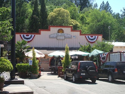
Piano Quiz 1 grading preceeds this at Tio Pepe's,

with views of the old fire- and

court-

houses,

then into Auburn Ravine below

Foresthill Bridge (highest in California and third in country, after spans in Colorado and West Virgina),

along the Middle Fork of

the American River,

ascending Old Foresthill Road past digger pines and

the former limestone quarry,

Beyond Foresthill, the scene opens up even more toward

distant still-snowy ridges and

the yaw

of the canyon.

Mosquito Ridge Road descends towards the national forest,

around Volcano and

Ladys [side-]Canyons to

Circle Bridge over

the North Fork of the Middle Fork,

then ascends Mosquito Ridge proper

past cliffs, and

Deadwood and

Balloon Ridges (I am not making up these names, at least not most of them...),

with views straight back down North Fork Middle Fork at Peavine Promontory (OK, I sort of made up that last one -- it's a prominent switchback at the top of the initial Mosquito Ridge Rade, just south of Peavine Canyon...).

Beyond Mosquito Narrows, the Ridge plateaux out into a long green tunnel, where cowbells justle in the towers of high pines, such that it its time to stop and record

A Walk Through California: Placer (Cows and Cars 1).

A few miles beyond California's (and the world's) northernmost giant sequoias,

at the quixotic Greek Store site,

by the crossing of Spruce Creek is the walk

in the castelated conifer corridor to the

pine-coney corner of

Robinson Flat

Road (perhaps four miles round trip -- walking uphill and coasting down with the mini bike -- high elevation... a gentle rise to c. 5900 ft, heading downslope again), and the solution is (as in Samuel Beckett) to go on (in this case, next time continuing on MRR east towards French Meadows, rather than north on RFR, an option also pondered).

For now, it's operation reverse in the dying light of the

Second and

First Mosquito Grade Cliffs (several years ago these were passed in smoldering revenge smoke, post fiery cataclysm);

the Middle Fork and
Rubicon Rivers upstream, and their confluence down (taken from Mosquito Saddle),

as well as further bailing past more Digger pines and

the North Fork Middle Fork Trail,

to Circle Bridge,

Volcano Canyon,

zipping down Foresthill Road past Everybody's Inn,

and all way over the Bridge.
